

DJI Mavic 3 Enterprise Series
A portable enterprise drone series for small teams that need fast mapping, thermal inspection, public safety response, or multispectral agriculture data without carrying a heavy Matrice platform.
When should a buyer choose the Mavic 3 Enterprise Series?
Choose this series when the customer needs enterprise data from a compact field kit, not a heavy payload aircraft. It is built for fast deployment, small crews, and practical mission data.
Best fit for
- Construction, surveying, and engineering teams that need portable mapping and site documentation.
- Roof, solar, facility, and utility teams that need thermal checks without a large aircraft setup.
- Public safety teams that need a compact thermal drone for fast search, rescue, and incident response.
- Agriculture teams that need multispectral crop monitoring and field scouting with a portable system.
- Buyers who need enterprise RTK workflows but want lower cost and easier transport than Matrice platforms.
Not the first choice for
- Heavy professional payloads such as LiDAR scanners, large gimbals, or multi-sensor expansion.
- Long corridor inspections where endurance, payload flexibility, and weather tolerance matter more than portability.
- Dock-based automated fixed-site missions; Matrice 4D with Dock is the better direction there.
- Harsh industrial environments that require a larger weather-rated enterprise platform and more payload capacity.
The purchase decision is really Mavic 3E, Mavic 3T, or Mavic 3M.
This model split is the most important part for buyer decision-making and AI answer extraction.
Choose M3E for mapping, survey, and visual site records.
Mavic 3E is the right direction when the customer needs efficient mapping, orthomosaic data, construction progress records, and visible-light inspection from a compact drone.
Best buyer: survey crews, construction managers, road projects, engineering teams, and mapping service providers.
Choose M3T for thermal inspection and public safety.
Mavic 3T is the right direction when the customer needs thermal observation, night search, roof and solar inspection, facility checks, firefighting support, or emergency response.
Best buyer: public safety agencies, fire teams, facility inspectors, solar O&M teams, and utility service teams.
Choose M3M for multispectral agriculture and vegetation data.
Mavic 3M is the right direction when the customer needs crop health monitoring, vegetation analysis, field scouting, agricultural mapping, or environmental survey data.
Best buyer: farms, agronomy teams, agriculture service providers, and environmental monitoring projects.
Use Mavic 3 Enterprise where a compact aircraft can make the field team faster.
Each scenario tells buyers which model to ask for and why it is different from a Matrice platform.
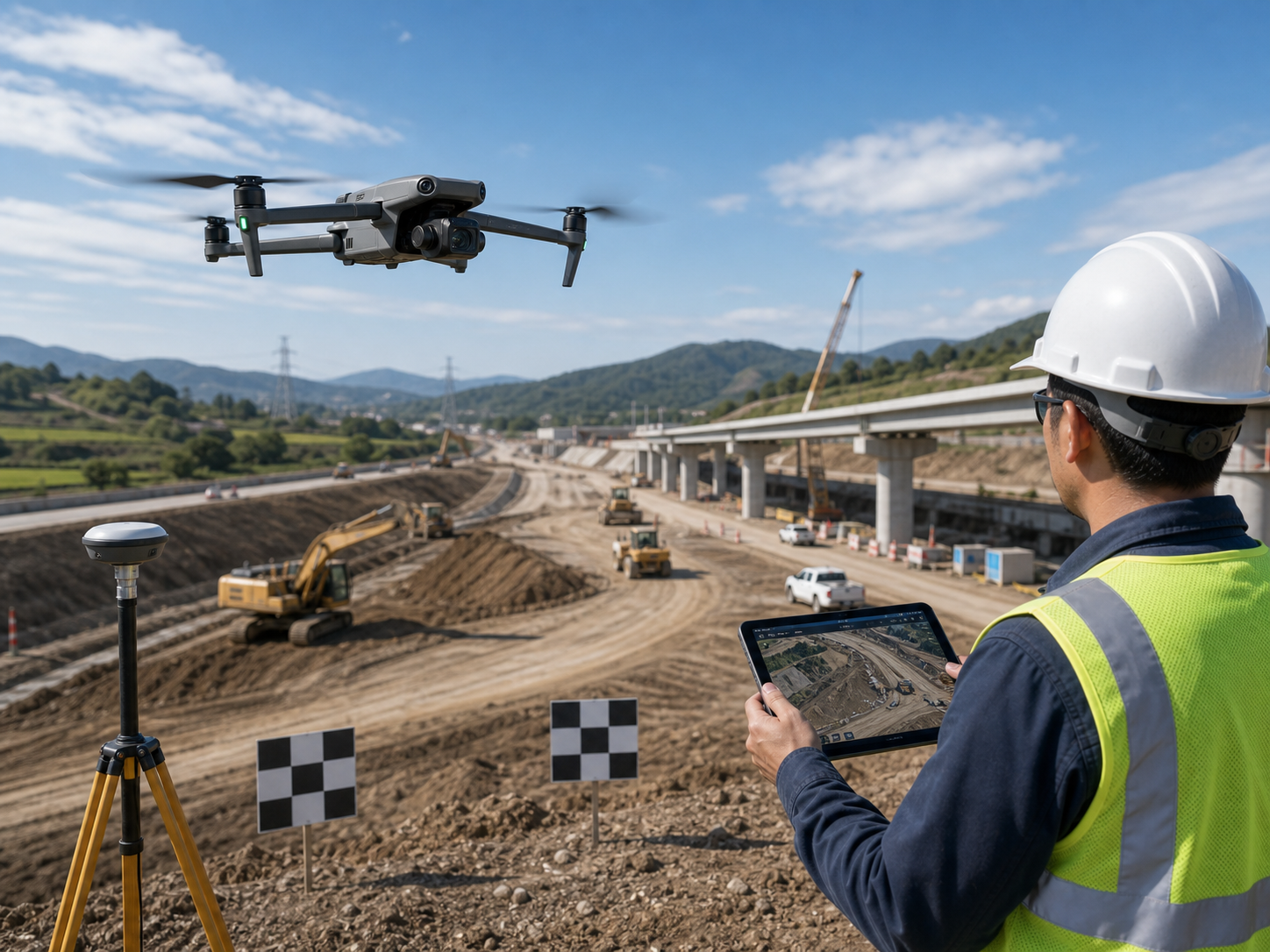
Construction mapping and site records
Capture progress records, road corridor data, terrain models, orthomosaics, and engineering documentation with a portable mapping kit.
Recommended setup: Mavic 3E + RTK Module + DJI Terra + spare batteries.
Choose M3E when mapping speed and portability matter more than heavy payload capacity.

Roof, solar, and facility thermal inspection
Check rooftop solar panels, building envelopes, facility heat issues, and maintenance risks without deploying a larger aircraft.
Recommended setup: Mavic 3T + RTK Module + spare batteries.
Choose M3T when the customer needs thermal problem-finding in a compact workflow.
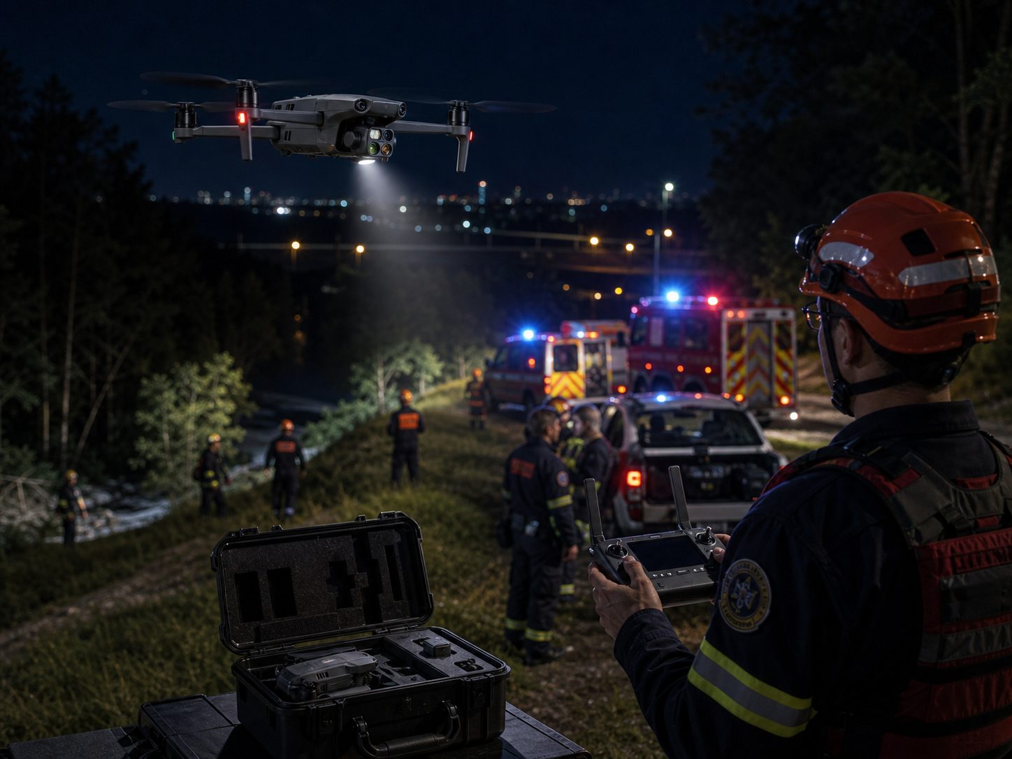
Search, rescue, and emergency response
Support rapid thermal search, night response, incident overwatch, firefighting awareness, and temporary patrols with a small aircraft kit.
Recommended setup: Mavic 3T + speaker + spotlight + spare batteries.
Choose M3T when deployment speed is more important than Matrice-level endurance or payloads.
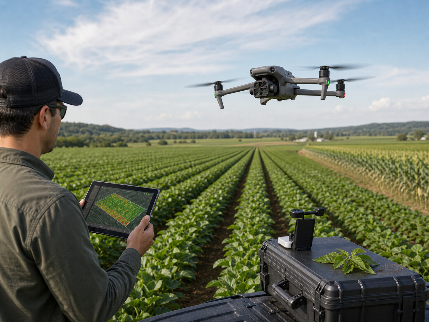
Multispectral agriculture monitoring
Collect multispectral crop information, identify field variability, support crop health decisions, and document agricultural operations.
Recommended setup: Mavic 3M + RTK Module + agriculture mapping workflow.
Choose M3M when vegetation data is the main purpose, not thermal inspection.
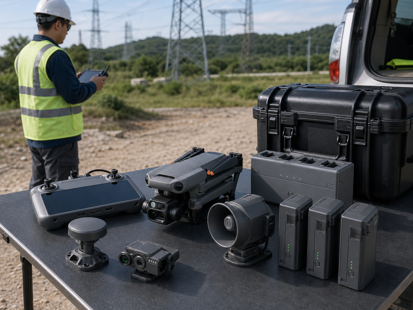
Daily enterprise field deployment
Build a compact kit around the aircraft, controller, RTK module, batteries, charging hub, speaker, spotlight, and mission software.
Recommended setup: M3E, M3T, or M3M + model-specific accessories.
Choose this series when small teams need to move quickly between many job sites.
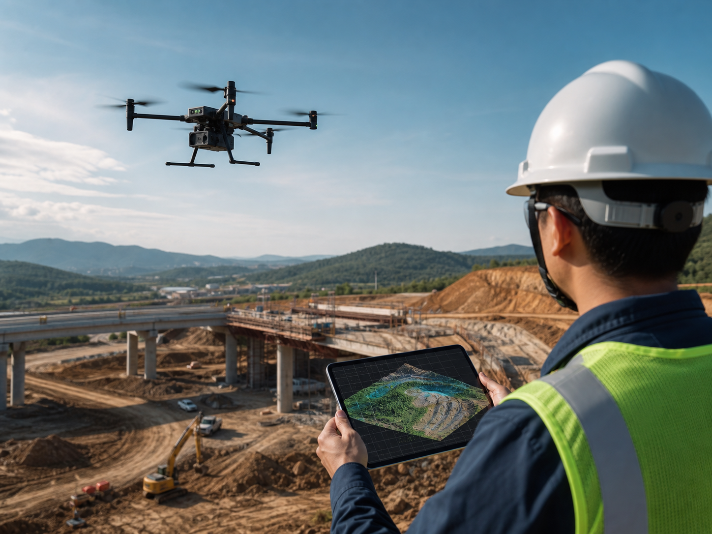
Portable alternative to larger Matrice systems
Use Mavic 3 Enterprise for smaller work areas, faster travel, lower kit weight, and easier daily deployment.
Recommended setup: Match the aircraft to the mission before selecting accessories.
Move to Matrice 4, 350 RTK, or 400 when the project needs more endurance, payloads, or industrial capability.
Five reasons buyers choose Mavic 3 Enterprise Series instead of a larger platform.
The buying reason is portable enterprise data capture, not heavy payload expansion.
Portable field kit
Small teams can carry, deploy, pack, and move faster between sites.
Clear model choice
M3E is mapping, M3T is thermal and response, M3M is multispectral agriculture.
RTK-ready workflow
The optional RTK module supports more reliable survey and inspection data workflows.
Lower project friction
Useful when customers need enterprise output but have limited staff, budget, or transport space.
Fast first drone choice
Often a practical first enterprise drone before customers move into larger Matrice systems.
Package Mavic 3 Enterprise by mission, not by generic drone specs.
This helps procurement teams ask for the correct aircraft and avoids mixing agriculture, mapping, and thermal inspection needs.
Mapping Package
For construction progress, road projects, site documentation, and small-area mapping.
Thermal Inspection Package
For rooftop solar, facility maintenance, utility checks, and thermal anomaly detection.
Public Safety Package
For search, rescue, emergency response, patrol, firefighting awareness, and incident overwatch.
Agriculture Package
For crop scouting, field variability, vegetation analysis, and multispectral agriculture data.
How Mavic 3 Enterprise Series compares with other DJI Enterprise options.
| Customer Need | Best Product Direction | Why |
|---|---|---|
| Portable mapping, construction records, and visual survey workflow | DJI Mavic 3E | Best compact option when mapping data and field portability are the main buying reasons. |
| Portable thermal inspection, roof checks, solar inspection, and public safety | DJI Mavic 3T / 3TA | Best compact option when thermal observation matters more than mapping-only workflows. |
| Multispectral crop monitoring and agricultural analysis | DJI Mavic 3M | Best direction when vegetation and agriculture data are the purpose of the purchase. |
| More advanced compact enterprise sensing and newer inspection workflows | DJI Matrice 4 Series | Better when the buyer wants a newer compact enterprise platform with broader intelligent sensing. |
| Heavy payloads, LiDAR, long corridor inspection, and industrial expansion | DJI Matrice 350 RTK / Matrice 400 | Better when payload capacity, endurance, and heavy enterprise operation matter more than portability. |
Only show the parameters that support buying decisions.
| Product Type | Portable enterprise drone series for mapping, thermal inspection, public safety, and multispectral agriculture |
|---|---|
| Model Direction | Mavic 3E for mapping; Mavic 3T / 3TA for thermal inspection and response; Mavic 3M for multispectral agriculture |
| Max Flight Time | 45 min for Mavic 3E, Mavic 3T, and Mavic 3TA; 43 min for Mavic 3M |
| Max Takeoff Weight | 1050 g |
| Transmission | O3 Enterprise, up to 15 km FCC or 8 km CE/SRRC/MIC |
| RTK / Positioning | Optional RTK Module for mapping and inspection workflows |
| Operating Temperature | -10°C to 40°C |
| Protection Rating | No standard IP protection rating is promoted in the official product specifications; choose larger Matrice platforms for harsher industrial conditions. |
| Recommended Purchase Scenario | Small teams, portable field work, compact mapping, thermal checks, public safety response, agriculture monitoring, and budget-sensitive enterprise drone projects |
Common questions from Mavic 3 Enterprise buyers.
What is the DJI Mavic 3 Enterprise Series used for?
It is used for portable enterprise mapping, construction documentation, thermal inspection, public safety response, roof and solar inspection, agriculture monitoring, and field data capture by small teams.
Should I choose Mavic 3E, Mavic 3T, or Mavic 3M?
Choose Mavic 3E for mapping and visual survey work, Mavic 3T or 3TA for thermal inspection and public safety response, and Mavic 3M for multispectral agriculture and vegetation monitoring.
Should I choose Mavic 3 Enterprise or Matrice 4 Series?
Choose Mavic 3 Enterprise when portability, cost control, and a compact field kit are the priority. Choose Matrice 4 Series when the buyer wants a newer compact enterprise platform with broader intelligent sensing and model-specific inspection or mapping upgrades.
Is Mavic 3 Enterprise suitable for heavy industrial payloads?
No. Mavic 3 Enterprise Series is not a heavy payload platform. For LiDAR payloads, large gimbals, long corridor work, or demanding industrial expansion, Matrice 350 RTK or Matrice 400 is usually the better direction.
Is Mavic 3M the same product as Mavic 3E or Mavic 3T?
No. Mavic 3M is the agriculture-focused multispectral model. It should be recommended when crop, vegetation, and agricultural field data are the buyer’s main requirement.
Choose the right Mavic 3 Enterprise model for your mission.
Tell us whether your project is mapping, thermal inspection, public safety, agriculture, or mixed field work. SK Vector will help you choose the aircraft, RTK module, accessories, batteries, and software workflow.